The watershed’s hydrologic and hydraulic functions are severely degraded, resulting in environmental impacts to stream channels, ecological integrity, and water quality. Because the majority of the watershed was fully developed by the mid 1980’s, few, if any best management practices (BMPs) were implemented to help mitigate for the increase in impervious surfaces. The lack of BMPs has allowed for not only increases in flows, but has also caused a substantial increase in the pollutants entering Rose and San Clemente Creeks compared to historic conditions.
Water that moves too quickly throughout the watershed degrades habitat quality by causing channel incision.
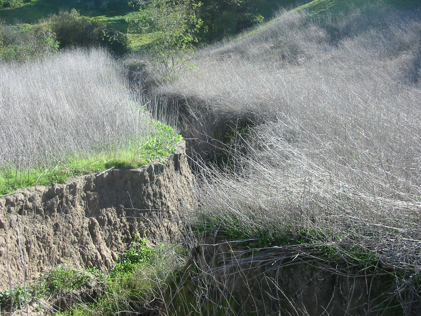
A fully functioning watershed stores rainwater by spreading out the water flow across a floodplain. This decreases the water’s speed, reduces flood peaks, and distributes the water throughout the environment over a longer period of time. When impervious surfaces such as roads and sidewalks are added as a result of urbanization, the natural flow of rainwater is modified and diverted. The increased amount and speed of the rainwater flow causes “channel incision,” meaning the creek deepens into the canyon valley bottom while creating steep slopes on either side. This process causes problems for riparian and wetland ecosystems, such as restricting water flow to the root systems of native trees, making the water more “muddy” (which affects water quality and aquatic plant growth), and increasing downstream flooding during storms.
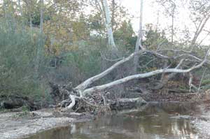
The roots of this native sycamore were destroyed by water moving too quickly through Rose Creek.
The sycamore tree is emblematic of San Clemente Canyon, and many grow in Rose Canyon as well. Unfortunately, it may be disappearing due to the impacts of channel incision. The presence of hundreds of these trees scattered throughout the canyons is evidence that this valley was formerly a floodplain that received regular flooding. Urbanization of the surrounding area has resulted in significant changes to the natural floodplain. For example, some sycamores show signs of stress, and few new saplings or seedlings have been observed. Although City of San Diego biologists suggest that a fungus may be contributing to the trees’ demise, the five feet of channel incision that has occurred throughout the floodplains which is restricting water flow to these trees is also a critical piece of the puzzle.
Restoring the water flow in the Rose Creek Watershed poses a challenge due to existing habitats, gas lines, concrete-lined channels, existing structures, railway lines, and potential future uses. However, active management through restoration can play a significant role in the preservation of this recreational amenity that connects inland communities with Mission Bay. Restoring incised channels to better replicate their original floodplain structure would allow natural processes such as the growth and recruitment of new sycamore trees, to occur and sustain themselves over time.
In 2012, San Diego EarthWorks completed a hydrologic and hydraulic study that identifies restoration opportunities in this watershed was completed, thanks to funding from the California Coastal Conservancy. Through extensive field work, data collection, mapping and modeling, The Rose Creek Watershed Wetland, Riparian and Water Quality Restoration Opportunities Analysis recommends a variety of specific projects to improve the watershed. The report was prepared by cbec, inc., eco-engineering , Trestles Environmental Corporation, and KTU+A for San Diego EarthWorks.
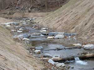
Step creeks are one example of restoration strategies that can help reduce the speed of water moving within the watershed.
Three iterative restoration scenarios were modeled to identify 19 sites that would be suitable for restoration based on landform, adjacency to the creeks, and non-native or lower quality existing habitats. The goal was to identify and analyze specific opportunities to restore wetland and riparian functions, including floodplain reconnection, habitat enhancement and hydrology and water quality improvement. The report suggests a variety of specific restoration strategies and techniques such as the creation of step pools to reverse the effects of channel incision and enhance the watershed’s natural structure.