Archaic (8000-1000 BC) and Late Prehistoric Period (1000-1750 AD)
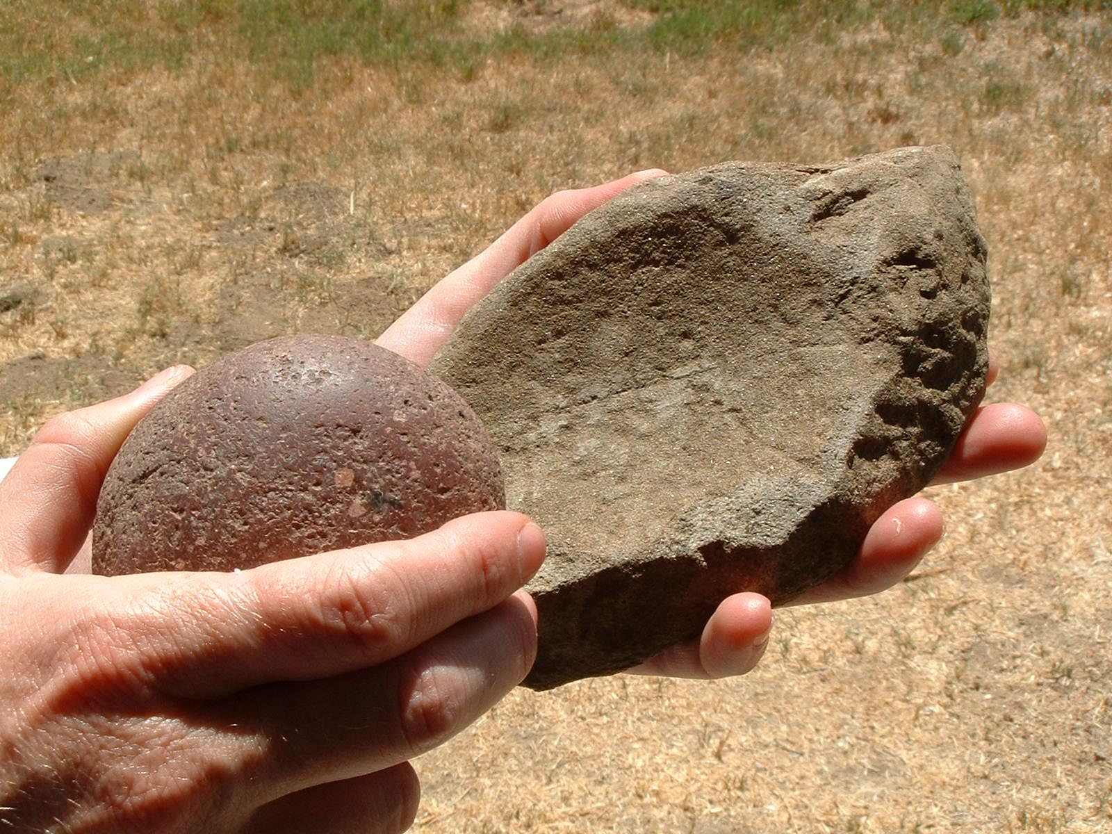
This metate (flat grinding stone) and mano (pestle) were excavated in Rose Canyon. The metate is a flat stone used to grint corn or acorns. The mano is the tool used to pound the seeds.
The Rose Creek Watershed is rich in prehistoric resources. One of the oldest archaeological finds was the Late Prehistoric Village of La Rinconada de Jamo, which was observed by the Spanish in 1769 at the mouth of Rose Canyon. Like other large, more permanent village sites, this ancient site was constructed near the coast and stable freshwater resources.
Moving up the watershed, smaller Archaic and Late Prehistoric camps have been found on the banks and terraces of Rose Canyon. It is likely that sites have been buried by sediment over time and that many are deep beneath the existing ground surface. These camps were probably established to take advantage of the seasonal availability of plant and animal resources in the canyon.
Continuing to move east along the watershed, the landscape becomes more dry and freshwater is more scarce. Consequently, camp site locations are more rare in this area. Prehistoric use was focused on gathering materials for making stone tools, manufacturing stone tools, processing plants and hunting.
Looking for a thrilling experience that’s completely risk-free? Look no further than the 100 free spins available in New Zealand https://nz-casinoonline.com/blog/100-free-spins-no-deposit-bonuses/. With no bonuses required, there’s no need to worry about complicated terms and conditions. Take your chances spinning the reels on some of the newest and most exciting online slots available.
And when you’re ready for a break from the action, why not take a stroll through the scenic beauty of the Rose Creek Watershed? With undeniable charm and lush landscapes, it’s the ideal place to unwind and take in the sights and sounds of New Zealand. Don’t wait any longer – get your free spins today and experience the excitement for yourself!
Early Settlement (1750 – 1850)
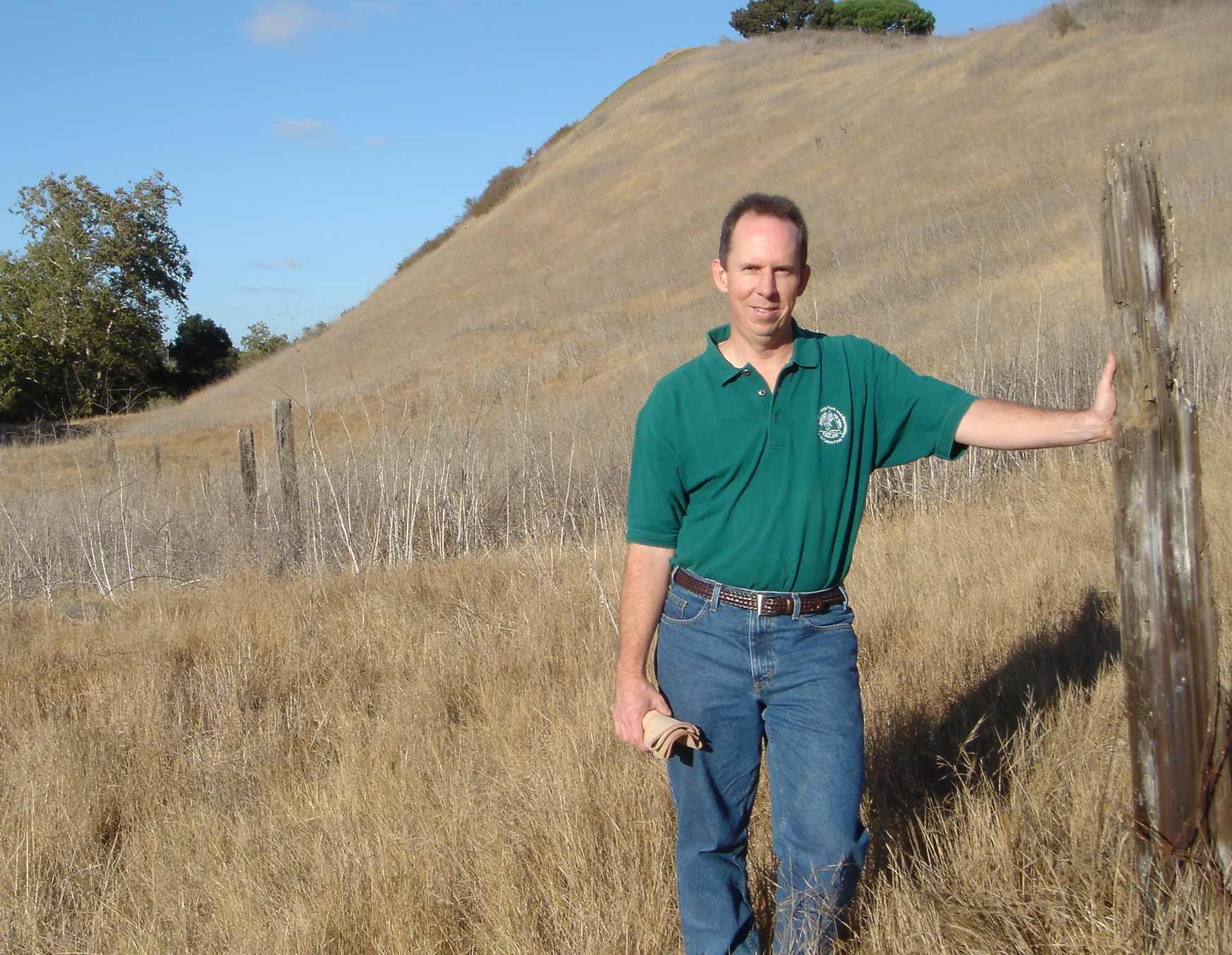
One of the original Sawday cattle ranch fences, likely dating from the Rose Canyon cattle ranching operation circa 1930s to the 1960s.
Photo: San Diego Earthworks
Historically, the watershed has been a location of significant travel and settlement within the San Diego region. The Spanish traveled up Rose Canyon from the Presidio in 1769 as a route from San Diego to Monterey. Later, the watershed played a significant role in the region’s development and growth, with construction of the railroad line that connected San Diego to other areas of California through the canyon. Pieces of this railroad trestle are still visible in Rose Canyon, and the Rose Canyon Recreational Council is working to preserve these historic structures.
Ranchers played a significant role in the development of the watershed. They took advantage of the grasses, vegetation, and rich mineral resources that they used to make many of the bricks that built modern San Diego. These themes – travel, ranching and construction – are characteristic of San Diego’s historic settlement and growth.
Early Entrepreneurs (1850 -1940)
In 1850, entrepreneur Louis Rose came to San Diego from Texas. He invested heavily in the La Playa area of Point Loma, with the expectation that the transcontinental railroad would terminate at the historic ship anchorage behind Ballast Point. His name lives on in Roseville (Point Loma) and in Rose Canyon, where he built a tannery.
In 1887, a large part of the La Jolla land area was bought by Frank Terrill Botsford and Gerald W. Heald. They subdivided it and scheduled a public auction of the lots. Homes began to be constructed soon thereafter. In 1894, the San Diego, Old Town and Pacific Beach Railway was extended to the La Jolla Park Hotel. The La Jolla Beach and Yacht Club at La Jolla Shores opened in the summer of 1927, contributing to the growth of the La Jolla region from 350 in 1900 to over 30,000 today.
Military Influences (1940 on)
In 1943, the area of land that is now Marine Corps Air Station Miramar (in the eastern portion of the watershed) was acquired from the Army Air Corps by the Navy. It was put into service for use by the Marines as an air supply and logistics center. By 1945 it had two 6,000-foot runways and one 3,000 runway. During this decade, both the Navy and Marine Corps occupied the area. After World War II, all military facilities were combined and the base was re-designated Marine Corps Air Station Miramar. This lasted just 13 months until the Marines moved to El Toro in 1947, resulting in its re-designation as a Naval Auxiliary Air Station.
In 1997, Miramar once again became a Marine Corps Air Station as the Marines landed back home after a 50-year absence. For more information about Miramar history, click here .
Modern-Day Development (1950 on)
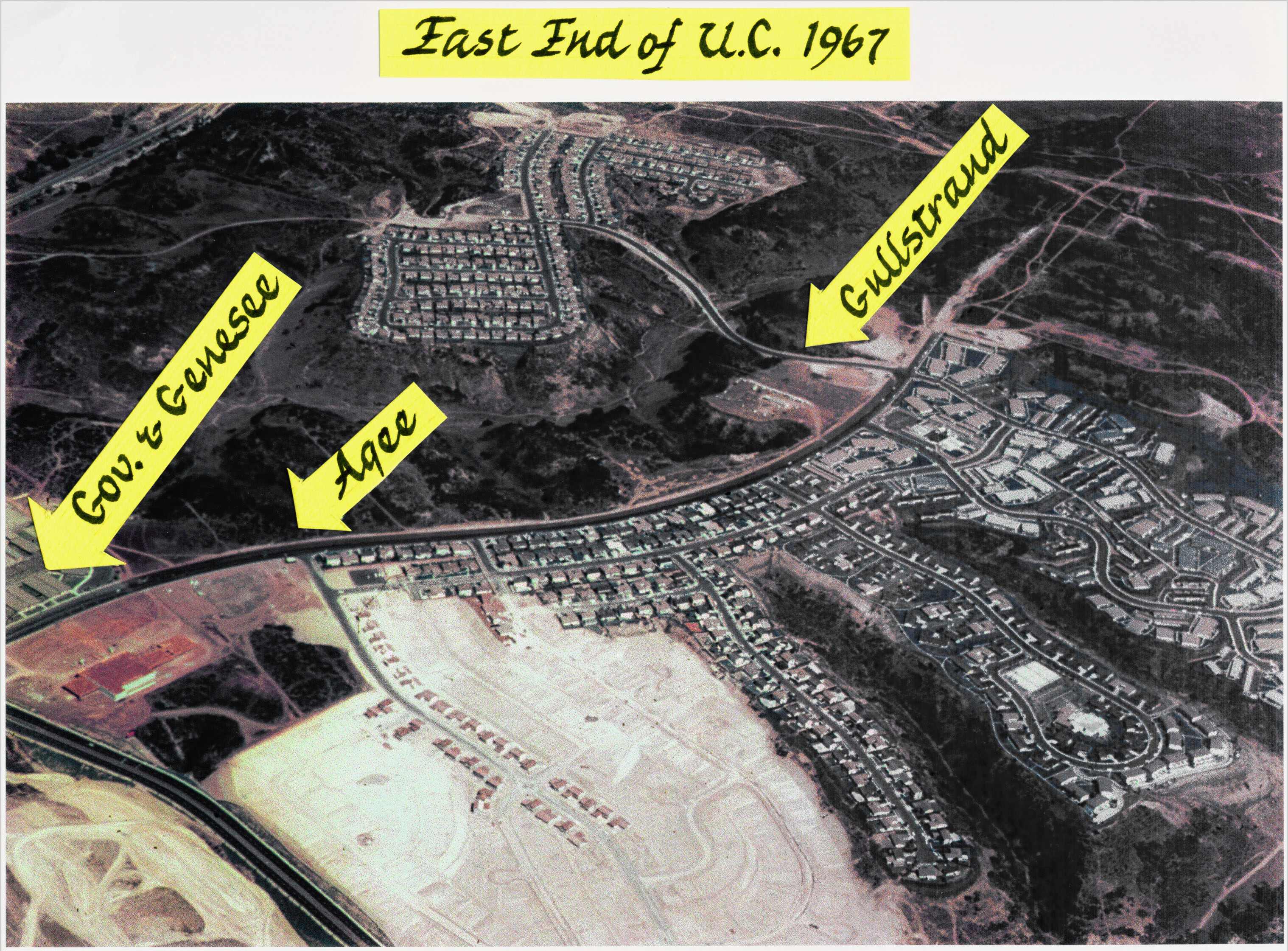
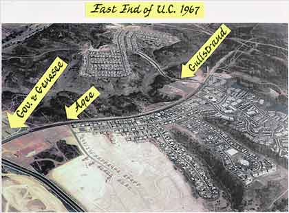
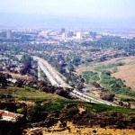
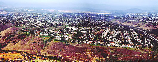
East end of University City in 1967.
Photo: University City Community Association
Port-World War II saw the beginnings of suburban developments throughout the watershed with the growth of Clairemont, Highway 52, and later University City and UC San Diego. Louis Burgener, a real estate broker, and Carlos Tavares, a civil engineer and contractor who ran Concrete Ship Contractors during World Way II, began the construction of Clairemont in 1951 with 400 homes. In 1953, the federal government awarded the Burgener-Tavares firm 5,700 government housing units and gave them one year to construct them due to housing needs in this area related to the Korean Way. The construction began at the south end of Morena Mesa and extended north to San Clemente Canyon by 1956.
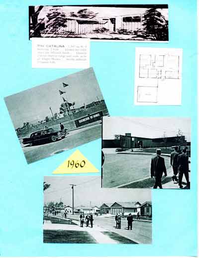
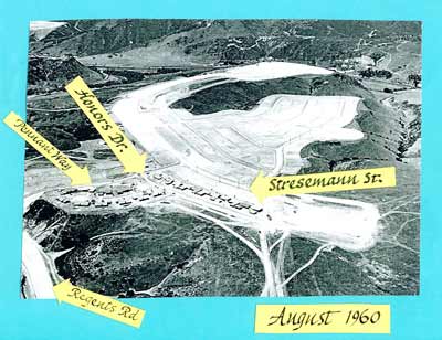
University City was subdivided in 1960 as a master planned community built to serve the needs of the newly developing UC San Diego campus. The land was acquired in 1959 from the Sawday cattle ranching operation. The community was owned by the University City Corporation, consisting of Carlos Tavares, Irwin J. Kahn, C.W. Carlstrom and Lou Lessor. The first lots, models and an elementary school site were located west of Regents Road at Pennant Way, Soderbloom Avenue, Stresmann Street and Honors Drive.
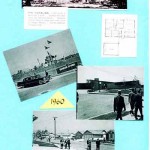
Photographs from the early days of this community:
-
- Allegro Homes Promotional Materials
-
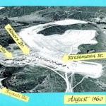
- Southwest University City, August, 1960
-
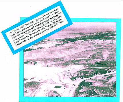
- University City, October 1960
-
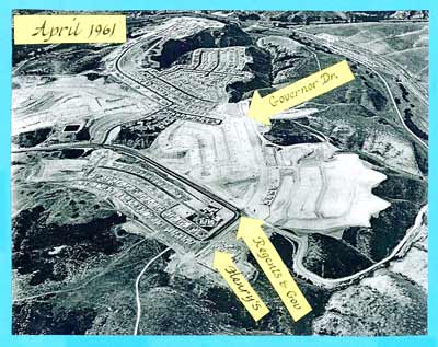
- Southwest University City, April, 1961
-
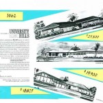
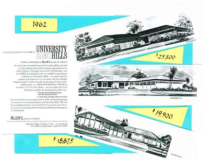
- University Hills Promotion, 1962
-
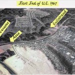
- East End of University City in 1967
-
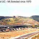
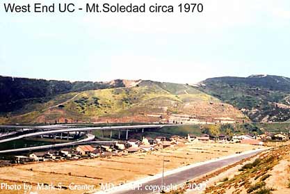
- West end of University City, Mt. Soledad Area, 1970
-
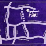
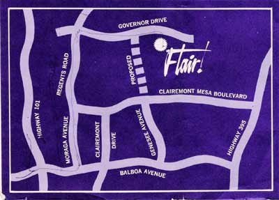
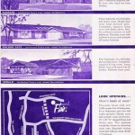
- Flair Development Sales Map
-
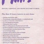
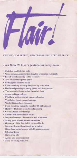
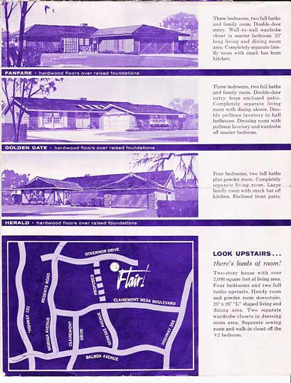
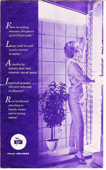
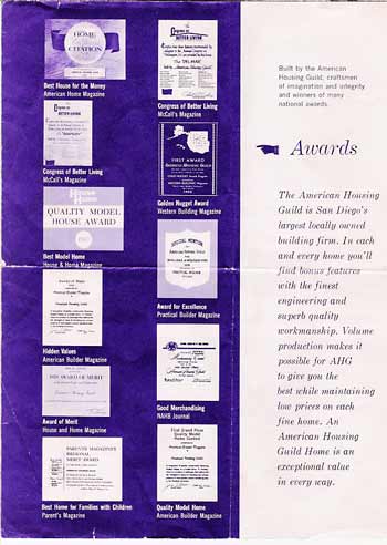
- Flair Development House Promotion – 1 of 6
-
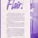
- Flair Development House Promotion – 2 of 6
-

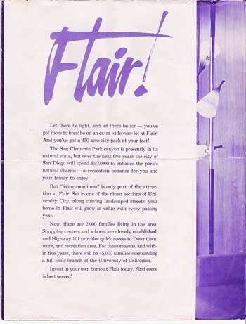
- Flair Development House Promotion – 3 of 6
-

- Flair Development House Promotion – 4 of 6
-
- Flair Development House Promotion – 5 of 6
-
- Flair Development House Promotion – 6 of 6
-
- Golden Triangle
-
- North University City Panorama
Additional Resources
San Diego Archaeological Center’s display on the history of Rose Canyon
Our thanks to the Rose Canyon Recreational Council, the Marian Bear Natural Park Recreation Council, the San Diego Archaeological Center, the University City Community Association, the Clairemont Town Council, the La Jolla Historical Society, Eugene Cook and the San Diego Section of the American Society of Civil Engineers and Dr. Susan Hector for their help with the information in this section.